You have no items in your shopping cart.
RSS

Blog

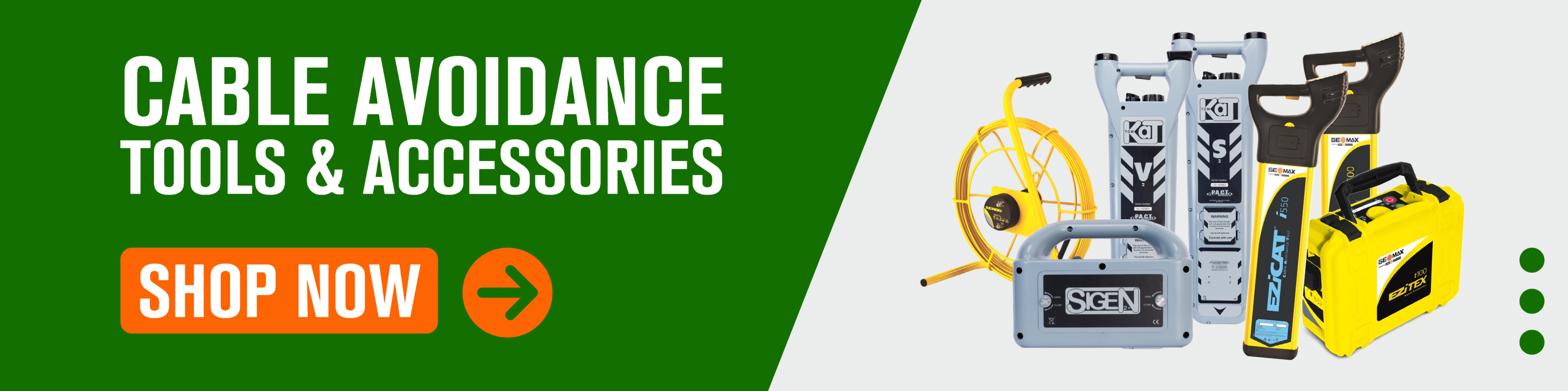
Choosing the Right Cable Avoidance Tools (CATs): A Buyer's Guide

If you are working within or with the underground utilities sector or are, at any point, breaking ground, you must ensure that adequate precautions are taken to avoid risk to persons at work arising from possible underground dangers such as underground cables. Using the right cable avoidance tools (CATs) will ensure the safety of your team and help you avoid costly damage and delays.


So how do you pick the right cable avoidance tools?

With so many different brands offering range of products, it’s hard to decide which is the best for you and your budget. Before you make a purchase there are a few questions you need to ask yourself. 


1. What kind of accuracy do you need?

You need to consider your application and think of distances over which you would ideally like to trace. Wat about the depth of the services? Do you need to be able to measure that as well?

Average cable locator will provide you with the lateral position of any services detected and used with a signal generator can operate using the two industry-standard detection frequencies of 8khz and 33khz.

But if you need something more advanced, there are models that can emit two additional frequencies and detect signals over longer distances. They are also able to provide a depth reading.


2. Will you be using the CAT in isolation or with a signal generator?

Best practice requires you to always use a cable avoidance tool in contact with a signal generator. It doesn’t mean you have to but using a Genny will help you find about 50% buried services, since CAT can only detect a cable if it has current flowing through it.

Note: It is very important that you always use the correct signal generator and cable avoidance tool combination.


3. Are you just marking-up services on the ground or do you need to store that data for later analysis?

Any basic tool will do if you’re just marking the ground for a surveyor who will do the mapping or to avoid cutting a wire. But if you need to be able to record data yourself, you may want to look at more advance models, like the ones with the GNSS technology and software included.


4. How experienced are you/your employees in using these tools?

You don’t need to be an expert to use cable detection tools, however having a basic understanding of how they work is necessary for you to use a utility locator correctly. If you don’t have much experience, it’s often best to start with a simple tool and get familiar with it, before upgrading to more advanced one. No point spending money on something you won’t be able to use.


Conclusions and recomendations

As industry standards get more and more regulated, it makes sense to buy the best and most recent cable and pipe location technology. Still, it’s important to take under consideration all the above factors. You need to make sure to pick the tool that ensures safety but also fits your needs and budget.

---

At Hitechniques we offer a range of detection tools for every job and budget. If you need help picking the right ones for you, get in touch with us at 01 257 2323 or info@hitechniques.ie


GNSS Rover vs Total Station: Which Surveying Tool is Right For You?

Surveying, the art and science of determining the position of points on the Earth's surface, has been an essential part of human civilization for centuries. From the construction of ancient pyramids to modern skyscrapers, accurate measurement has always been the cornerstone of great architectural feats. As technology has evolved, so have the tools we use for these measurements.


GNSS Rovers and the Total Station are two of the most popular surveying instruments in the modern era. Both tools have revolutionised the way we approach land measurement, offering precision and efficiency that were once deemed impossible. Our customers and trainees often ask us about differences between a GNSS Rover and a Total Station and which one is better. Our initial answer is always the same: It depends. Each has particular pros and cons which can be utilised in various situations. The main difference between the total station and the GNSS rover is that the total station depends on your input for its location and orientation, while the GNSS rover has a location and orientation from a series of satellite constellations. Both are highly advantageous if used in their correct environment. So how do you know which one is the best fit for a particular project?


In this article, we'll delve deep into the functionalities, advantages and ideal scenarios for each instrument. By the end, you'll have a clearer understanding of both tools, empowering you to make an informed decision based on your specific needs. Whether you're a seasoned surveyor or someone just stepping into the world of land measurement, this guide aims to provide clarity and insight into the world of GNSS Rovers and Total Stations.


Understanding the Basics: GNSS Rover and Total Station

Before diving into the specifics of when and where to use each tool, it's crucial to grasp the fundamental concepts and functionalities of both the GNSS Rover and the Total Station.

GNSS Rover

  • Definition: A GNSS (Global Navigation Satellite System) Rover is a mobile, ground-based device that receives signals from multiple satellite constellations, including GPS, GLONASS, Galileo and Beidou.
  • Functionality: The Rover determines its position based on the signals it receives from these satellites. It doesn't require a fixed reference point on the ground, making it highly versatile for various surveying tasks.
  • Key Features:
    • Autonomy: Works independently without the need for a fixed station setup.
    • Mobility: Easily carried around, allowing for rapid data collection.
    • Satellite Reliance: Uses multiple satellite constellations for improved accuracy and coverage.

Total Station

  • Definition: A Total Station is an electronic/optical instrument used for surveying and building construction. It integrates the functions of a theodolite (for measuring angles) and an electronic distance metre (for measuring distances).
  • Functionality: The Total Station measures angles and distances from the instrument to a specific point. These measurements are then used to determine the coordinates of the point relative to the instrument's location.
  • Key Features:
    • Precision: Offers high accuracy, often within millimetres.
    • Local Coordinates: Can survey or stake out from user-defined local coordinates.
    • Georeferencing: With additional tools or references, it can provide georeferenced data.

While both tools are designed for precise measurement, their methodologies differ significantly. The GNSS Rover relies on satellite signals, making it ideal for open terrains and larger areas. In contrast, the Total Station's reliance on direct line-of-sight measurements makes it perfect for detailed, localised projects where high precision is paramount.

In the following sections, we'll explore the practical applications of each tool, helping you discern which instrument aligns best with your project's requirements.


When to Opt for a Total Station

The Total Station, with its precision and versatility, is a stalwart in the world of surveying. Its capabilities make it the preferred choice for many projects, especially those requiring meticulous detail and high accuracy.


Description of Total Station

  • Integrated Measurement: The Total Station combines the functionalities of a theodolite and an electronic distance metre, allowing it to measure both angles and distances with precision.
  • Direct Line-of-Sight: Unlike the GNSS Rover, the Total Station requires a clear line of sight to its target, ensuring pinpoint accuracy in measurements.
  •  

Practical examples and case studies showcasing the effectiveness of Total Station

  • Construction Sites: When setting out foundations, aligning structures, or installing holding down bolts for buildings, the precision of a Total Station is paramount. Its accuracy ensures that every element is placed correctly, down to the millimetre.
  • Urban Environments: In densely built-up areas with tall buildings, the Total Station's line-of-sight operation is more reliable than satellite signals, which can get obstructed.
  • Indoor Surveys: For projects inside buildings, such as retrofitting or interior design mapping, the Total Station is the go-to tool, given that satellite signals are ineffective indoors.
  • Archaeological Sites: When excavating historical sites, where every detail matters, the Total Station provides the accuracy needed to map and document findings meticulously.
  • Case Study - Historical Monument Restoration: A team was tasked with restoring a centuries-old monument. Using a Total Station, they meticulously mapped every detail of the structure, ensuring that the restoration was faithful to the original design. The tool's precision was crucial in documenting minute details, from intricate carvings to alignment of pillars.
  • Setting out with high accuracy required: If holding down bolts are being installed for a structural steel building, the 1-man robotic total station is the only surveying tool that should be used. Brickwork, formwork, and façade elements should only be set out with a Total station.
  • Static survey for house set out: This method can be used over a longer time to reduce errors and get a higher accuracy. Houses can also be set out but must be checked with the 6-point check with measuring tapes for square and accuracy. The 6-point check consists of the 2 side dimensions, the front and back dimensions and the 2 diagonal dimensions. These dimensions can be found on X-PAD surveying software through the Info tab with your choice of 2 points.

While the Total Station is a powerhouse in terms of accuracy and detail, it does require a more extended setup and might not be the best choice for vast, open terrains or rapid data collection. Recognizing the strengths and limitations of each tool is crucial in selecting the right instrument for the task at hand.


When to Use a GNSS Rover

The GNSS Rover, with its satellite-based operation, offers a unique set of advantages that make it the go-to choice for specific surveying scenarios. Let's delve into its primary features and the situations where a GNSS Rover shines the brightest.


Description of GNSS Rover

  • Satellite Integration: The GNSS Rover taps into multiple satellite constellations, ensuring a broad coverage and reducing the chances of signal dropouts.
  • Quick Setup: Unlike traditional surveying tools, the GNSS Rover doesn't require an elaborate setup. Turn it on and it's ready to collect data.

Real-world scenarios and case studies where GNSS Rover is the ideal choice

  • Topographic Surveys: When mapping the contours and features of a landscape, the GNSS Rover's mobility comes into play. Its ability to quickly move around and record points without the need for line-of-sight makes it a top choice for such surveys.
  • Large Area Surveys: For projects that span vast areas, like agricultural land surveys or forest mapping, the GNSS Rover's efficiency is unmatched. Its satellite-based operation allows for faster data collection over extensive terrains.
  • Remote Locations: In places where setting up a base station is challenging, the GNSS Rover's independence from ground-based reference points proves invaluable.
  • Rapid Data Collection: In scenarios where time is of the essence, such as disaster-stricken areas that need quick mapping for relief operations, the GNSS Rover's quick setup and operation can be a lifesaver.
  • Case Study - Coastal Erosion Mapping: A team of surveyors was tasked with mapping the erosion patterns along a stretch of coastline. Using a GNSS Rover, they could quickly move along the beach, recording data points even in areas where traditional tools would struggle due to lack of line-of-sight or unstable ground for setup.
  • Setting out where accuracy is less than 25mm: For housing estates, the GNSS rover can be used to set out foundations and roadways, manholes and kerb lines and boundary walls.

While the GNSS Rover offers unparalleled advantages in the above scenarios, it's essential to recognize its limitations, especially in environments with obstructions or when ultra-high precision is required. In such cases, other tools like the Total Station might be more suitable, as we'll explore next.


Head-to-Head: Advantages of Each Tool

When choosing between the GNSS Rover and the Total Station, understanding the distinct advantages of each tool can guide your decision. Let's break down the primary benefits of both instruments.

Advantages of the Robotic Total Station

  • Precision: The Total Station boasts an accuracy of +/-1-2mm, making it one of the most precise surveying tools available.
  • Versatility in Challenging Environments: Whether you're working under trees, close to buildings, or even indoors, the Total Station can deliver reliable results where satellite signals might falter.
  • No Subscription Needed: Unlike some GNSS systems that require network subscriptions, the Total Station operates independently, reducing ongoing costs.
  • Urban Efficiency: In densely populated urban areas with tall structures, the Total Station's line-of-sight operation proves more reliable than GNSS systems that can experience signal obstructions.
  • Network Independence: Your surveying work isn't dependent on a connection to a network or GSM Signal for corrections, ensuring consistent operation.

Advantages of the GNSS Rover

  • Rapid Deployment: The GNSS Rover can start working immediately in the field without the need for stationing, saving setup time.
  • Vast Area Coverage: For land surveying, there's no limit to the area that can be surveyed with a GNSS Rover and tasks can often be completed faster than with a Total Station.
  • No Line-of-Sight Required: Unlike the Total Station, the GNSS Rover doesn't need a direct line of sight to record a point, as long as there are no overhead obstructions.
  • Cost-Effective: GNSS Rovers are generally cheaper to purchase and their adaptability to various conditions offers value for money.
  • Flexibility and Mobility: The ease of carrying a GNSS Rover and its resilience against being knocked over makes surveying tasks more convenient and time-efficient.

In essence, the choice between the GNSS Rover and the Total Station boils down to the specific requirements of your project. While both tools offer unique advantages, understanding their strengths in various scenarios will ensure you select the most effective instrument for your needs.


Decoding Technical Terms

In the world of surveying, various technical terms and jargon can sometimes be overwhelming, especially for those new to the field. To ensure clarity and a better understanding of the tools discussed, let's break down some of the terms mentioned in this article.


ITM (Irish Transverse Mercator)

  • Definition: ITM is the official coordinate system for Ireland, replacing the Irish Grid system. It's designed to be compatible with GPS and is based on a transverse Mercator projection.
  • Application: ITM is used for mapping and land surveying in Ireland, providing a standardised system for accurate measurements.

Irish Grid Coordinates (also known as National Grid)

  • Definition: The Irish Grid is a map reference system used in Ireland prior to the introduction of ITM. It's based on a transverse Mercator grid projection of the geographical coordinates of latitude and longitude.
  • Application: While it's being phased out in favour of ITM, some older maps and surveying data might still use the Irish Grid system.

GNSS (Global Navigation Satellite System)

  • Definition: GNSS is a general term for satellite navigation systems that provide autonomous geo-spatial positioning with global coverage. This includes systems like GPS (U.S.), GLONASS (Russia), Galileo (EU) and Beidou (China)and other regional satellite constellations.
  • Application: GNSS is used in various applications, from navigation in vehicles to high-precision surveying tools like the GNSS Rover.

Georeferencing

  • Definition: Georeferencing means associating something with locations in physical space. In surveying, it's the process of assigning real-world coordinates to each pixel of the raster, usually done with the help of control points.
  • Application: Georeferencing is crucial in ensuring that survey data aligns correctly with other geographical data, making it essential for tasks like map creation or overlaying images on existing maps.

6-Point Check

  • Definition: A method used in surveying to ensure accuracy by checking two side dimensions, the front and back dimensions and two diagonal dimensions.
  • Application: This method is particularly useful in tasks like house set-outs to ensure the structure is square and accurate.

By understanding these terms, you can better grasp the intricacies of surveying and the tools used in the process. Whether you're a professional in the field or someone looking to embark on a surveying project, a clear understanding of these technicalities ensures a smoother, more informed experience.


The Evolution of GNSS Receivers

As technology continues to advance, so do the tools and instruments we use in surveying. One such tool that has seen significant evolution over the years is the GNSS receiver. Let's delve into its progression and understand why it's become an indispensable asset in modern surveying.


From GPS to GNSS

  • GPS (Global Positioning System): Initially, receivers were designed to track only the U.S.-based GPS satellite constellation. While revolutionary at the time, this system had its limitations, especially in areas where satellite coverage was sparse.
  • GNSS (Global Navigation Satellite System): With the development and operationalization of other satellite constellations like GLONASS (Russia), Galileo (EU), and Beidou (China), receivers evolved. They transitioned from being solely GPS-focused to multi-constellation devices, capable of tracking signals from various systems simultaneously.

Benefits of Tracking Multiple Satellite Constellations

  • Improved Coverage: By accessing multiple constellations, GNSS receivers can provide better coverage, especially in challenging environments like urban canyons or dense forests.
  • Enhanced Accuracy: More satellites mean more signals to triangulate a position, leading to increased accuracy in measurements.
  • Redundancy: If one satellite system faces issues or outages, the receiver can still function using signals from other constellations, ensuring uninterrupted operation.
  • Faster Signal Acquisition: With more satellites in view, GNSS receivers can acquire signals faster, reducing the time it takes to get a position fix.
  • Global Operability: Regardless of the geographical location, GNSS receivers can provide accurate positioning data, making them ideal for international projects or operations.

Tough Environments and GNSS Receivers

Today's GNSS receivers are designed to be resilient. Their ability to track multiple satellite constellations means they can provide reliable data even in challenging environments:

  • Near Buildings: In urban areas with tall structures, GNSS receivers can still function effectively by tapping into various satellite signals.
  • Under Tree Canopy: Dense forests that might block signals from one constellation won't necessarily block signals from another, ensuring continuous operation.
  • Deep Cuttings or Mines: Even in areas with significant obstructions, the versatility of GNSS receivers, combined with their multi-constellation tracking, ensures accurate data collection.

In conclusion, the evolution of GNSS receivers from single-system devices to multi-constellation powerhouses has revolutionised the world of surveying. Their adaptability, accuracy and resilience make them a cornerstone in modern measurement and mapping endeavours.


Conclusion

The realm of surveying has witnessed remarkable advancements over the years, with tools like the GNSS Rover and the Total Station leading the charge. As we've explored in this article, each instrument offers a unique set of advantages tailored to specific scenarios and requirements.

The GNSS Rover, with its satellite-based operation, is a testament to the wonders of modern technology. Its ability to quickly and efficiently cover vast terrains, combined with the flexibility of operation, makes it an invaluable asset for many surveying projects.

On the other hand, the Total Station stands as a beacon of precision and reliability. Its meticulous accuracy and versatility in both urban and challenging environments underscore its importance in projects that demand pinpoint measurements.

However, beyond the technicalities and specifications, the essence of this discussion boils down to one fundamental principle: Choosing the right tool for the job. Whether you're mapping a vast agricultural land, setting out foundations for a skyscraper, or restoring a historical monument, understanding the strengths and limitations of each tool is paramount.

In an ever-evolving world, where projects grow more complex and the demand for accuracy intensifies, having a clear grasp of available tools becomes crucial. It's not just about measuring distances or angles; it's about ensuring that every project stands on a foundation of precision, reliability and excellence.

As we wrap up this exploration, remember that the landscape of surveying will continue to evolve. New tools and technologies will emerge, but the core principle will remain unchanged: Equip yourself with knowledge, choose the right instrument and aim for perfection in every measurement.


Further Resources and Contact Information

For those eager to delve deeper into the world of surveying and the intricacies of tools like the GNSS Rover and Total Station, we've compiled a list of resources to guide your journey. Whether you're a seasoned professional or a curious novice, these materials can provide valuable insights and knowledge.

Recommended Reading


Contact Us

For personalised guidance, tool recommendations, or any other queries, our team is here to assist you.

  • Phone: Call us at +353 (0)1 257 2323 for immediate assistance.
  • Email: Drop us a message at info@hitechniques.ie and we'll get back to you promptly.
  • Office: If you prefer face-to-face consultations, visit our office: Hitechniques Ltd., Unit 17 Block Q, Grants Road, Greenogue Business Park, Rathcoole, Co. Dublin, D24 N252, Ireland
  • Demo and Consultation: Schedule a demo to see our tools in action or book a free consultation to discuss your project's specific needs.

Remember, the world of surveying is vast and ever-evolving. Continuous learning, coupled with the right resources and guidance, can ensure you stay at the forefront of this exciting field.


Things to consider when buying used surveying equipment

There is a lot of measurement equipment available on the market for construction companies and surveyors. You can pick from hundreds of different models and, whatever your requirements, you'll always find one that will suit your needs perfectly. However, buying tools like GNSS Rovers or total stations is a big investment, especially for individuals and small companies.

When basing your budget on a lower scale, purchasing a second-hand unit from an authorised dealer can be a great option. You can save a lot of money and still get quality instruments that are fully serviced and certified. It usually comes with original packaging and with all the accessories included. Warranty is also something that most authorised dealers offer when selling used instruments. But before you take that leap of faith and buy pre-owned instrument, there are a few matters to think about.


Five things to consider before buying used surveying equipment

1. Cost

There is no doubt that you can save a lot of money buying used equipment and since survey equipment is considered business equipment you can write it off as an expense to your company.


2. Type of equipment you need

Consider all the features and functions that are necessary for your work. If you’re only starting in the business maybe less expensive, pre-owned units will be a better practice tool? Or maybe you just don’t really need the latest technology and don’t feel like paying extra for something you don’t have use for.


3. Frequency of use 

If you need the instrument on daily basis but can’t afford a new one, buying used is definitely worth considering. However, if surveying work is more one-off type work, it may be worthwhile hiring instead.


4. Warranty and support 

Always check what kind of warranty you will get, when buying second hand and if you’re entitled to the same support services as customers buying new tools.


5. Available payment options 

Some companies offer payment plans. If you don’t have the cash, it can be a great help, too. 


Buying pre-owned surveying equipment can be a great way to upgrade while saving money as long as you make a well educated decision. Don't be afraid to ask questions and check the instrument you want to buy before commiting. It's still a great investment and you want to make sure you get your money's worth.

---

If you’re considering buying used surveying or construction equipment, get in touch with us. Whatever your budget, we can help find the right instrument for you.We will help you choose the kit and software according to your experience and the type of projects you work on. And if needed, we also offer a training service to help you get familiar with the new instrument.

Give us a call at 01 257 2323 or email us at info@hitechniques.ie


Five tools you should add to your toolbox

If you're a DIYer, you probably love stocking up your toolbox, always in need of a good hammer, set of pliers, some new power tool, meters of duct tape... You know the drill. (See what we did there ;)

As your skills improve, you start taking on more demanding projects and large renovation jobs, which often involve plaster and drywall work, electrical, plumbing, tile, or concrete. And these require tools that are a bit more advanced than a sledgehammer and a measuring tape.

To help you choose from hundreds of gadget and devices available on the market, we've created a short list of our own favourites from the Laserliner range, that will definitely help you do the job without breaking the bank.


1. DistanceMaster Pocket laser distance meter

With measuring precision of ± 2 mm, surface and volume calculation, and versatile calculation and memory functions, DistanceMaster Pocket is a great help when you are fitting in a new kitchen or tiling the bathroom. And the Wall Surface function that automatically adds up surfaces by measuring the lengths of walls as well as their height once is very handy, too, helping you calculate the amount of material needed for the project more accurately.


2. DampMaster Compact moisture tester

A moisture meter is an essential instrument used to detect moisture content in materials. Home and building inspectors rely on moisture meters to identify potential problems and damage to structures from moisture build-up. It is also handy when you’re moving to the next stage of works and want to make sure your plastering or concrete floor is dry enough.


3. ActiveFinder XP voltage tester

Cheap and easy to use, a small hand-held voltage tester can be, quite literally, a lifesaver. Inexpensive and reliable voltage testers such as the Laserliner ActiveFinder XP can detect electrical current without touching the exposed wires. It locates electrical voltages in cables, sockets, bulb sockets or fuses and finds breaks in wires and cables.


4. MultiFinder Plus universal detector

Whether you’re trying to find a wire in a wall or avoid one while hanging your new shelves, working with reclaimed wood or locating pipes, this is the tool for you. It’s easy to use, inexpensive and reliable. The permanent voltage function ensures your safety, while Auto-Calibration function adjusts the device to different surfaces immediately after switching on.


5. SmartCross-Laser self-levelling cross line laser

Cross-line lasers are great for any kind of levelling or plumbing tasks, installing drop ceilings or aligning cabinets. Laserliner SmartCross-Laser produces 2 very visible laser lines and has the slope mode for aligning angled surfaces.

You don’t need all these tools to get by for basic home DIY but this list includes items you should definitely consider as you start building up your tool kit or work in home renovation business.

---

If you have any questions about the products or need some advice, just give us a call at 01 257 2323. We’ll be happy to help.


The Pros and Cons of Buying vs Renting Surveying Equipment for Your Business

The decision between buying and renting surveying equipment is a critical one for businesses in construction, engineering, and environmental research. Surveying tools, which include advanced technologies like GPS systems, laser levels, and drones, are indispensable for the accuracy and efficiency they bring to projects. This choice goes beyond a simple financial consideration; it's about aligning with the company's operational needs and strategic goals.

On one hand, buying surveying equipment represents a significant investment in the company's future, promising long-term utility and the assurance of asset ownership. It suggests a commitment to ongoing projects and a readiness to deploy these tools at a moment's notice. Conversely, renting offers unparalleled flexibility and access to the latest technologies without a substantial upfront financial commitment. It allows businesses to adapt to project-specific needs and avoid the depreciation and maintenance concerns associated with ownership.

Each option has its distinct advantages and disadvantages, shaped by factors like the nature and duration of projects, frequency of equipment use, budget limitations, and the rapid pace of technological innovation in surveying instruments.

This article delves into the pros and cons of buying versus renting surveying equipment. Our goal is to provide business owners with a detailed analysis that considers financial implications, operational flexibility, and the strategic positioning of their business. Through this exploration, we aim to equip decision-makers with the insights needed to choose an option that best suits their business's unique circumstances and long-term objectives.


Understanding Surveying Equipment Needs

Before delving into the debate between buying and renting surveying equipment, it's essential to understand the specific needs of your business and the role that such equipment plays in your operations. Surveying equipment encompasses a wide range of tools designed for measuring and mapping the Earth's surface.

These include traditional instruments like theodolites and levels, as well as modern technologies such as GPS (Global Positioning System) devices, laser scanners, and unmanned aerial vehicles (UAVs) or drones. Each tool serves a unique purpose, from establishing property boundaries to constructing buildings and infrastructure, or even conducting environmental and geological surveys.

The decision to buy or rent is significantly influenced by several factors. The frequency of use is a primary consideration; businesses that require surveying equipment on a regular basis may find purchasing more cost-effective in the long run. Conversely, for projects that are short-term or require specialised equipment infrequently, renting may be a more viable option. Budget constraints also play a crucial role, as the high upfront cost of purchasing the latest surveying technology may not be feasible for all businesses. Additionally, the size and scope of projects can dictate the type and amount of equipment needed, further influencing the buy vs. rent decision.

Understanding your business's specific surveying needs, considering the project types you undertake, and evaluating your financial capacity are critical steps in making an informed decision between buying and renting surveying equipment.


The Pros of Buying Surveying Equipment

Investing in surveying equipment by purchasing it outright can offer several advantages to businesses, particularly those with frequent or specialised needs. Here are some of the key benefits:

  • Long-term Cost Savings: For businesses that use surveying equipment regularly, buying can be more economical over time. Although the initial investment is significant, owning equipment eliminates ongoing rental fees, providing cost savings in the long run. This is especially true for equipment with a long lifespan and for companies that can maximise its usage across multiple projects.
  • Availability and Accessibility: Owning surveying equipment ensures it is available whenever it is needed, without the delays or uncertainties associated with rental availability. This can be crucial for businesses that face tight project deadlines or need to mobilise quickly for unexpected opportunities. The convenience of having equipment on hand can significantly enhance operational efficiency and project turnaround times.
  • Customisation and Familiarity: Purchasing equipment allows businesses to select the exact models and specifications that best fit their operational needs and preferences. Over time, users become familiar with their equipment, leading to increased efficiency and reduced errors. This familiarity also allows for Customisation of the equipment setup, optimising it for specific tasks or preferences, which is not always possible with rented gear.
  • Resale Value: Surveying equipment, especially well-maintained and high-quality items, can retain significant resale value. Businesses can recoup a portion of their initial investment by selling equipment when it is no longer needed or when upgrading to newer technology. This resale value can offset the cost of future purchases, making the initial investment more palatable.
  • No Dependency on Rental Companies: Owning equipment means businesses are not subject to the terms and conditions of rental agreements, which can sometimes include usage restrictions, limited availability, and fluctuating rental rates. Ownership eliminates these concerns, providing businesses with complete control over how and when the equipment is used.
  • Tax Advantages: Purchasing surveying equipment can offer tax benefits, such as depreciation deductions and possible incentives for capital investments. These financial advantages can further offset the cost of purchasing equipment, making it a more attractive option for businesses looking to maximise their investment.

Buying surveying equipment offers long-term cost savings, availability, Customisation, potential resale value, independence from rental companies, and tax benefits. These advantages make it a compelling option for businesses with regular and ongoing needs for surveying equipment, providing a solid foundation for operational efficiency and financial planning.


The Cons of Buying Surveying Equipment

While purchasing surveying equipment has its advantages, there are also significant drawbacks that businesses must consider. Here are some of the main cons associated with buying surveying equipment:

  • High Initial Investment: The most apparent disadvantage of buying surveying equipment is the substantial upfront cost. Advanced surveying technologies can be expensive, and for small businesses or startups, this initial outlay can strain budgets or divert funds from other critical areas. The high cost can also be a barrier to accessing the latest technology, potentially putting a business at a competitive disadvantage.
  • Depreciation and Obsolescence: Surveying equipment, like any technology, depreciates over time. As newer models are released, older equipment can lose value rapidly, both in terms of resale value and operational efficiency. The pace of technological advancement in surveying means equipment can become obsolete quickly, leaving businesses with outdated tools that may not meet the evolving standards of precision and efficiency required for modern projects.
  • Maintenance and Repair Costs: Owning surveying equipment means taking on the responsibility for its maintenance and repair. Regular upkeep is necessary to ensure equipment remains accurate and functional, which can incur significant costs over time. Unexpected repairs can also lead to project delays and further expenses, impacting a business's bottom line and operational efficiency.
  • Storage and Transportation: Purchased equipment requires proper storage and transportation to and from project sites. This adds logistical considerations and costs, including the need for secure storage facilities and potentially specialised transportation methods to protect sensitive equipment. These additional responsibilities and expenses can add up, especially for businesses with extensive equipment inventories.
  • Reduced Flexibility: Buying equipment locks a business into using specific tools for an extended period. This can reduce operational flexibility, making it challenging to adapt to project-specific needs or take advantage of new technologies without additional investment. Renting, on the other hand, allows businesses to choose the most suitable equipment for each project, ensuring they always have access to the best tools for the job.
  • Capital Tied Up in Equipment: Funds used to purchase surveying equipment are tied up in physical assets, which may limit a business's ability to invest in other areas, such as marketing, research and development, or expanding the workforce. This can slow growth and reduce a company's agility in responding to market changes or opportunities.

The cons of buying surveying equipment include significant initial costs, the risk of depreciation and obsolescence, ongoing maintenance and repair expenses, storage and transportation challenges, reduced operational flexibility, and capital tied up in physical assets. These factors must be carefully weighed against the benefits of ownership to determine the best approach for each business's unique situation.


The Pros of Renting Surveying Equipment

Renting surveying equipment presents a flexible and often cost-effective alternative to purchasing, especially for businesses with variable project demands or those looking to minimise upfront investments. Here are the key advantages of renting over buying:

  • Flexibility and Adaptability: Renting allows businesses to select equipment that is precisely tailored to the requirements of each project. This adaptability is crucial for projects that require specialised tools not frequently used, enabling companies to access the latest technology without the commitment of a purchase. As project needs change, rental agreements can be adjusted accordingly, ensuring the right tools are always at hand.
  • Reduced Financial Burden: One of the most significant benefits of renting is the elimination of a large initial investment. Businesses can conserve capital and maintain liquidity by paying for equipment only when it is needed. This can be particularly advantageous for startups or companies with limited budgets, allowing them to allocate resources to other areas such as research, development, and marketing.
  • Maintenance and Upkeep: Rental companies typically handle maintenance and repairs, ensuring that equipment is in optimal working condition. This relieves the renting business of the time and expense associated with equipment upkeep. Additionally, if a piece of equipment fails, the rental company is usually responsible for providing a replacement, minimising downtime on projects.
  • Access to Latest Technology: Renting offers the opportunity to use the latest surveying equipment without the depreciation concerns associated with ownership. This access ensures that businesses can utilise advanced technology to enhance accuracy and efficiency on projects, staying competitive in their field without the need for continual investment in new equipment.
  • No Long-Term Storage Requirements: Without the need to own equipment, businesses avoid the costs and logistics associated with long-term storage. This is particularly beneficial for companies with limited space or those that operate in multiple locations, as it reduces the need for secure storage facilities and the risk of equipment damage during off-use periods.
  • Tax Benefits: Rental expenses are often fully deductible as business expenses in the year they are incurred, providing immediate financial benefits. This contrasts with the depreciation deductions associated with purchased equipment, which are spread over several years.

Renting surveying equipment offers flexibility, reduced financial burden, maintenance and repair coverage, access to the latest technology, no long-term storage requirements, and potential tax advantages. These benefits make renting an attractive option for businesses looking to stay agile and efficient in their operations.


The Cons of Renting Surveying Equipment

While renting surveying equipment offers flexibility and financial benefits, there are also drawbacks that businesses need to consider. Here are some of the cons associated with renting:

  • Higher Long-term Costs: For businesses that use surveying equipment frequently and over extended periods, renting can become more expensive than buying. The ongoing rental fees can accumulate, making it a less cost-effective option for long-term needs, as opposed to investing in ownership which could pay off over time.
  • Availability Issues: Depending on the rental company's inventory and demand, the specific equipment needed for a project may not always be available. This can lead to delays or the need to compromise on the quality or specifications of the equipment, potentially affecting project outcomes.
  • Lack of Customisation: Rental equipment often comes in standard configurations that may not perfectly match every project's unique requirements. Businesses may find themselves adjusting their work processes to the equipment available, rather than having equipment tailored to their specific needs.
  • Dependency on Rental Company: Renting creates a dependency on the rental company for equipment availability, condition, and timely delivery. Any issues on the rental company's end, such as equipment shortages or logistical delays, can directly impact project timelines and efficiency.
  • No Equity Building: Money spent on rentals does not contribute to building asset equity for the business. Unlike purchased equipment, which can be considered a capital investment, rental fees are an expense without residual value, offering no return on investment beyond the rental period.

While renting surveying equipment provides immediate access with lower upfront costs, it may not be the most economical choice for frequent or long-term use. Businesses must weigh these cons against the pros, such as flexibility and access to the latest technology, to determine the best approach for their specific circumstances.


Making the Decision: Factors to Consider

When deciding whether to buy or rent surveying equipment, businesses must weigh several critical factors to align their choice with their operational needs and financial capabilities. Here are key considerations to guide this decision:

  • Frequency of Use: Evaluate how often the equipment will be used. Frequent use over multiple projects may justify the initial expense of purchasing, while occasional use may lean towards the benefits of renting.
  • Project Duration and Type: Consider the length and type of projects your business undertakes. Short-term or unique projects may benefit from renting specific equipment, whereas long-term projects might make purchasing more cost-effective.
  • Budget Constraints: Assess your company's financial health. If capital is limited, renting can preserve cash flow. However, if there's sufficient budget, investing in equipment can save money in the long run. I have calculated a 2 week per month period for a month at hire rates to show you the difference in costs and time in possession of a GNSS Rover.


*All prices exclusive of VAT

**Subscriptions based on 600 hours per year usage

This is also a forecast for how much work you will be undertaking and how much more you can take on to expand your efficiency in surveying.

  • Technological Advancement: The rapid pace of technological innovation in surveying equipment should be considered. Renting allows access to the latest technology without the risk of obsolescence, important in industries where precision and efficiency are continually advancing.
  • Financial Health and Planning: Beyond immediate costs, consider the impact on your business's financial planning. Purchasing can offer tax benefits through depreciation, while renting expenses are typically fully deductible.
  • Support: One of the common questions is regarding the level of support we offer you as a customer.
    “Will we get the same level of support once we buy the instrument as the level of support when we hire?”
    We’d like to assure you; we are as interested in our customers in purchase as in hire. All our customers get call backs and full support regardless of the system used. Our 360° Support was designed to solve all your issues quickly and efficiently. 
  • Knowledge and Experience: The training for the use of the instrument will have to be complete in hire and sale so no difference here, only that once you learn on one instrument you can only improve on the same instrument. We also notice our trainees are more comfortable using the same equipment they were trained on.

Making an informed decision requires a careful analysis of these factors, ensuring that the choice between renting and buying surveying equipment supports your business's strategic goals, operational efficiency, and financial sustainability.


Case Studies

Case Study 1: High-Tech Engineering Firm

A high-tech engineering firm decided to purchase advanced surveying equipment for their ongoing infrastructure projects. The decision was driven by the frequent use and the need for precision in their work. The investment paid off by enhancing operational efficiency and project accuracy, demonstrating the long-term value of owning equipment for businesses with continuous and specialised needs.


Case Study 2: Small Construction Company

A small construction company opted to rent surveying equipment for a series of short-term projects. This approach allowed them to access the latest technology without a significant upfront investment, effectively managing project costs and adapting to varying project requirements. The flexibility of renting proved ideal for their fluctuating demand and project-specific needs, showcasing the benefits of renting for businesses with diverse and temporary requirements.


Conclusion: Buying vs Renting Surveying

Deciding whether to buy or rent surveying equipment is a strategic choice that impacts a business's financial health and operational efficiency. By carefully considering the pros and cons of each option, businesses can make informed decisions that align with their project needs, budget constraints, and long-term goals, ensuring sustainable success.

For personalised advice on choosing the right surveying equipment for your business, reach out to our experts today.


Further Reading

To deepen your understanding of surveying equipment and its impact on your business decisions, explore the following resources:

  • Modern Surveying Techniques: Learn about the latest advancements in surveying technology and how they can benefit your projects. Read more.
  • Surveying Equipment Maintenance: Discover best practices for maintaining your surveying equipment to ensure longevity and accuracy. Read more.

---

At Hitechniques we offer both Hire and Sales services and create tailored solutions for construction companies as well as individuals. If you need advice or would like to discuss your options, get in touch with us at info@hitechniques.ie or call 01 257 2323.

Overcome the fear of upgrading

Conquering the Fear of Tech Upgrades

“If I buy it, I might not be able to use it”

From my experience many people hesitate to upgrade to new technology because they're afraid they won't be able to use it. The rapid pace of technological advancement can be daunting, making us feel like we're constantly playing catch-up. At Hitechniques, we're dedicated to helping companies confidently embrace the latest measurement technology. We provide comprehensive support every step of the way, ensuring a smooth transition to the next level. 

If you want to learn we will get you there.


A Practical Approach to Tech Adoption

Recently, an engineer from a Galway site contacted us, looking to handle site setup himself. He needed guidance on choosing the right equipment. After asking a few questions on what he is building, I picked a unit and went through what he needs. Based on his site criteria we made the choice between a GNSS rover and a robotic total station work.

I recommended the GeoMax Zenith35 PRO TAG GNSS Rover since he was just starting to set out foundations and groundworks around his site. It was our flagship GNSS rover at the time and the most popular system to learn, , offering cutting-edge technology, fast connections, and exceptional accuracy, significantly reducing stakeout time.


Hands-on Training and Support

Our demonstration was an introduction to the various functions and guide through the workflow. I showed the customer how to record and save data, stake-out and even create surface for volume calculation. The tutorials explained how to get through all the different functions, navigating through the site and the software. I also demonstrated how to create and choose from the code list in X-PAD software to start the customer with the important discipline of coding and essentially creating the right layer for the right survey description.

We finished up with answering the questions that came up during the demonstration.

With all that the customer was able to make a well-informed decision and opted to purchase a unit straight away, knowing he could now execute the basic functions and was able to transfer the survey from tablet to his PC and forward to his design engineer for further site development.


Confident Decision Making

After a 2 hours demonstration on a Tuesday morning the customer was able to choose his new equipment with the confidence that he’ll be able to use it and it will suit his immediate needs as well as long-term goals for his own and company's progression.


The Value of Guidance

With over 15 years in the construction industry, I understand the importance of leveraging the latest technology.  Proper guidance is key to successfully selecting the right equipment for your specific needs and long-term goals.  At Hitechniques, we provide that guidance, ensuring your technology upgrade is a success.

Multi-code in X-PAD
Multi-code in X-PAD

“When I am surveying, I want to include everything in the survey in one pass. How do I do this without having lines going where they shouldn’t be?”

We all remember the first time we surveyed out in the field in college or perhaps the first day with a GNSS Rover on a training course. The boundary joined to the gate, the gate joined to the man-hole and we had to edit all the lines when we went back to the office, having to recollect what line was an actual string and what was not.

Thankfully, we have come a long way from this and the software we use today has improved even more. It has considered these minor problems, anticipating how it can be streamlined for ease of use and producing more defined surveys.

A great example is one of the little-known elements of X-PAD surveying software - the Multi-code feature.


How to use Multi-code feature in X-PAD

There are 2 types of multi-code: Line - Point and Line - Line.


Line - Point Multi-code

The software is setup so that you cannot choose point and line codes simultaneously from the codelist. In this case you need to know the name of the code and type it into the code field. It will then attach both codes to the point and display whichever code is first in the code field. You can get the name of the code from the codelist, it is usually just 2 letters, e.g. WE=Weld, WC=Water Connection

Figure 1: Line - Point Multi-code, Watermain with welds & connections

Line - Line Multi-code

When surveying boundaries a typical scenario is surveying a fence in which there is a gate. You can just leave a gap for the gate, but to get a complete survey, or if someone else is completing the AutoCAD element of the survey, you need to indicate if there is just a gap or if there is a gate. This is easily done using the Multi-code functionality in X-PAD.

Other uses: A rail or fence on top of a wall, a fence which changes to a hedge/wall or vice versa

Figure 2: Fence with gate

Is Multi-code functionality worth it

The advantage of having this functionality is that it allows for a cleaner survey and reduced time taken to execute the task. While using these functions you minimise the time spent editing a survey in AutoCAD and, like I mentioned before, don't have to try remembering what points joined.

If you have the same issues, it doesn’t take long to iron them out and the little tweaks to old habits can make a huge difference in your presentation of work and bringing in the efficient lean techniques we can teach you.

If you have a survey question you want to ask or something that you don’t quite understand, why don’t you post it to us and we'll include it in our FAQ section with the answer for everyone’s benefit. You can leave a comment on our Facebook page or email your question to info@hitechniques.ie

Roch

A Deep Dive into Matterport's 3D Capture App: Features and Benefits

Matterport has become synonymous with advanced 3D capture technology, providing innovative solutions for creating immersive digital twins of physical spaces. Their cutting-edge technology aims to simplify workflows, enhance documentation processes, and elevate customer engagement.


The Matterport 3D Camera allows users to seamlessly scan and digitise spaces, creating highly accurate 3D models the Matterport Pro3 LiDAR Camera. This article delves into the features and benefits of the Matterport 3D Capture App, its applications in various industries, and how Hitechniques supports Irish businesses with comprehensive training and equipment solutions.


Understanding Matterport's 3D Capture App

Overview of the System

The Matterport 3D Pro 3 camera is designed to transform the way professionals capture and document physical spaces. By using the camera, users can create high-resolution digital twins of interiors, exteriors, and complex environments. The Matterport Capture App's intuitive interface makes it accessible to users with varying levels of technical expertise, enabling them to produce accurate 3D models quickly and efficiently.

Matterport's platform uses advanced photogrammetry and LiDAR technology to scan spaces, generating 360-degree views and 4K imagery. The resulting digital twins can be shared and accessed remotely, enhancing collaboration between teams and stakeholders. This capability is particularly beneficial in the AEC sectors, where efficient site documentation and virtual walkthroughs are increasingly in demand.


Expansion of Matterport Technology

Matterport has made significant strides in expanding its technology, making the app compatible with Android devices and integrating with various third-party cameras such as Ricoh and Insta360. This expansion ensures that users can access Matterport's powerful capture technology for use in areas where the accuracy of the Lidar camera is not required, thus broadening its accessibility to a wider range businesses and end uses.


Key Features of the Matterport 3D Capture App

User-Friendly Interface

The app’s intuitive design allows users to easily capture spaces, set up scans, and manage projects. Whether you’re using the Pro2 or Pro3 LiDAR camera, the app guides users through the scanning process, ensuring optimal results with minimal training. Additionally, the app provides real-time feedback, allowing users to monitor scan quality and coverage instantly.


High-Resolution 3D Scanning

The Matterport Pro2 and Pro3 cameras capture spaces in high resolution, producing detailed 3D models that include 4K photography and 360-degree views. The Pro3 LiDAR camera excels in capturing both indoor and outdoor spaces, thanks to its advanced laser sensor technology.

Below is a comparison of the key features between the Pro2 and Pro3 cameras:


Integration with Multiple Camera Systems

Matterport’s app is compatible with a wide range of cameras beyond Matterport’s own Pro series. This flexibility allows users to capture visual tours without 3D data using cameras such as Ricoh Theta or Insta360 models. This integration allows for weekly reporting on certain sized projects for example.


Real-Time Processing and Cloud Integration

The Matterport 3D Capture App processes scans in real-time and uploads the data to Matterport’s cloud platform. This cloud-based Cortex AI system then processes the material from the Capture App into the finished 3D model. Users can access, edit, and share digital twins from anywhere, making it an invaluable tool for collaboration, remote inspections, project updates, and client presentations.


Extensive Output Options

The Matterport platform offers several outputs, including MatterPak bundles, E57 files, and TruePlan assets, which can be imported into industry-standard software like AutoCAD, Revit, and Xactimate. This versatility ensures that Matterport’s digital twins integrate seamlessly into existing AEC workflows.


Benefits of Using the Matterport 3D Capture App

  • Improved Workflow Efficiency: Matterport’s technology significantly streamlines documentation, measurement, and reporting processes. By digitising spaces and creating virtual twins, professionals can reduce on-site visits, speed up approvals, and improve communication with clients and teams.
  • Cost-Effectiveness and Scalability: For businesses looking to optimise budgets, the ability to hire Matterport cameras allows flexibility in scaling operations. Hitechniques offers rental services for Matterport Pro2 and Pro3 cameras, enabling companies to leverage the technology for specific projects without long-term investments.
  • Enhanced Client Engagement: Matterport’s digital twins are perfect for creating immersive virtual tours, which can be shared with clients for property viewings, site inspections, or remote walkthroughs. This interactive experience enhances client engagement, especially in real estate, where virtual tours have become a critical tool for property sales.
  • Versatile Applications Across Industries: The Matterport 3D Capture App has applications beyond AEC sectors, including insurance, hospitality, and marketing. Its ability to create accurate, detailed models simplifies remote inspections, damage assessments, and promotional content, making it a versatile tool for various industries.


Practical Applications of the Matterport Technology

Architecture and Construction

Matterport’s 3D models enable architects and construction professionals to document site conditions, track project progress, and verify measurements. This data can be used for creating as-built models, project reports, and compliance documentation.


Real Estate and Property Management

Virtual tours are a powerful tool for property agents, allowing prospective buyers to explore properties remotely. Matterport’s technology helps increase engagement and accelerate sales by providing a realistic viewing experience.


Insurance and Loss Assessment

Accurate 3D scans are invaluable for documenting property conditions before and after incidents, ensuring thorough and reliable insurance assessments. By using Matterport’s digital twins, insurers can streamline the claims process and reduce disputes.


Hospitality

Hotels, event venues, and retail spaces use Matterport’s immersive tours to showcase their properties online, attracting more customers and driving engagement. Venues can allow clients to virtually visit the banqueting facility showing it set up for a wedding, conference, exhibition, or even multiple different setups for each event type.


Marketing

Matterport technology is also ideal for marketing agencies looking to create high-impact digital content. Many companies use the 3D virtual tours to show the correct merchandising of the stores, by recording one store and sharing with the brand’s other outlets.


Getting Started with the Matterport 3D Capture App

Downloading and Setting Up

To begin using the Matterport 3D Capture App, download it from the App Store or Google Play. Once installed, create an account and connect your Matterport camera or compatible device. The app provides step-by-step guidance to ensure users are ready to start capturing spaces immediately.


Capturing Your First Space

Start by setting up your camera and marking key features in the space you want to capture. Use the app to monitor scan coverage and quality in real-time. Once completed, the data is uploaded to Matterport’s cloud for processing.


Post-Production Tips

Optimise your digital twin by editing scans, adding labels, and customising navigation settings. Matterport’s platform allows users to enhance tours with 360 views, highlight reels, and Mattertags to create an interactive experience. Share the final tour via a unique link or embed it on your website.


Conclusion: Matterport's 3D Virtual Tours

Matterport’s 3D Virtual Tours offers unparalleled capabilities for professionals across various industries, from construction to real estate. At Hitechniques, we are committed to empowering Irish businesses with the latest in 3D capture technology and providing the training and support needed to maximise its potential.


Hitechniques Role in the Irish Market

Authorised Matterport Distributor and Training Provider

Hitechniques is the exclusive authorised distributor of Matterport cameras and solutions in Ireland. We provide the latest Matterport products, including the Pro2 and Pro3 cameras, available for purchase, lease, and hire. Our team is dedicated to helping Irish businesses leverage Matterport’s technology to streamline their operations and enhance project documentation.


Comprehensive Training Programmes

We offer specialised Matterport 3D Capture Training Courses designed to help users unlock the full potential of the technology. The training covers everything from optimal camera setup and scanning techniques to post-production editing using Matterport’s cloud platform. Participants will gain hands-on experience in creating digital twins, adding Mattertags, and using assets like MatterPak and TruePlan for integration into software such as Revit and AutoCAD.

Training is conducted in small groups to ensure personalised attention, with bespoke courses available for larger teams or specific business needs.

Transform your business with cutting-edge 3D capture technology—contact us today for expert guidance, equipment, and training solutions tailored to your needs. 

Maximise Compact Machine Potential with 3D Control

Compact machines have always been the Swiss army knife of construction sites—versatile, nimble, and essential. Their multi-functionality allows them to perform a variety of tasks with efficiency. However, the hesitation to invest in 3D machine control for these smaller machines remains prevalent due to perceived concerns about costs, operational complexity, and whether they’re a good fit for the types of projects they're involved in. The reality, though, is that not upgrading to this technology can mean missed opportunities for significant efficiency gains and cost savings.

For those considering whether it's time to upgrade, here are three reasons why integrating 3D machine control technology like Unicontrol3D into compact excavators is a game-changer.


Key Takeaways

  • Significant ROI: Unicontrol3D delivers up to 200% return on investment, reducing downtime and boosting project efficiency for compact machines.
  • Precision and Quality: Real-time 3D visual guidance improves accuracy in excavation, trenching, and fine grading, minimising costly rework.
  • Streamlined Documentation: Automatic surface logging and documentation simplify compliance, reducing the need for manual surveying.
  • User-Friendly and Supportive: The system is easy to set up, supports tilt-rotator functionality, and offers remote troubleshooting and updates.
  • Future-Proofing Your Fleet: Upgrading with 3D machine control prepares compact machines for future industry demands, ensuring long-term success.


Cost Efficiency and ROI

When it comes to machine control for compact equipment, Unicontrol3D delivers exceptional cost savings, with the potential for a return on investment reaching up to 200%. These systems are designed to align perfectly with the financial constraints and operational needs of small to mid-sized construction projects.

They provide not just cost-efficiency but also facilitate faster project turnover times. Investing in this technology may seem like a significant expense initially, but the rapid return on investment, combined with reduced downtime and improved efficiency, makes it a prudent choice for those looking to scale up their compact machinery capabilities.


Enhanced Precision and Quality Control

Compact machines are increasingly utilised for precision-based work, such as utility projects, trenching, and fine grading. Achieving high precision is critical in these operations to avoid costly rework and ensure high-quality outcomes.

Unicontrol3D helps operators enhance their machine's precision through real-time 3D visual guidance and design support. This means that operators receive accurate depth, slope, and contouring data directly in the cab, allowing for precise land levelling and excavation. The ability to make in-field adjustments based on live data not only ensures that the job is done right the first time but also accelerates completion rates, boosting both the quality and speed of project delivery.


Simplified Documentation and Workflow

The construction industry's documentation needs are becoming more complex as regulations tighten and project scope increases. Managing this growing need for data is no easy feat. Traditionally, maintaining accurate records and ensuring compliance have required frequent surveying and manual data collection, a process that is time-consuming and prone to error. Unicontrol3D streamlines this aspect by integrating documentation directly into its system. Operators can create advanced in-field designs on the fly and access real-time project visualisation directly on a tablet interface.

Documentation is logged automatically, with surface data recorded as the machine progresses through its tasks. This system ensures seamless and accurate data transfer between the field and the machine, reducing the burden on operators and eliminating the need for constant surveying. The result is a more efficient workflow that guarantees compliance and quality control without extensive manual intervention.


Core Features of Unicontrol3D

Unicontrol3D comes equipped with several standout features tailored to make machine control accessible and beneficial for compact equipment. Among these are:

  • Real-Time 3D Visual Guidance: This feature provides the operator with on-screen guidance, allowing them to follow design plans with precision.
  • Automatic Surface Logging: As the machine works, data is logged automatically, ensuring an accurate record of the work completed.
  • Support for Tilt-Rotator Functionality: For machines equipped with tilt-rotators, Unicontrol3D provides full support, allowing operators to take full advantage of their machine's capabilities.
  • Over-The-Air Support and Training: For ongoing support and updates, the system can be accessed remotely, allowing for seamless troubleshooting, software updates, and user training.
  • Simple Setup and Operation: Unicontrol3D's intuitive interface allows for easy setup and operation, even when machine operators change frequently.

These features make Unicontrol3D not only a powerful tool for enhancing the capabilities of compact machines but also one that is easy to implement and use, reducing training time and improving operational efficiency.


Future-Proof Your Fleet

The construction industry is in a constant state of evolution, with technology playing an increasingly important role in defining competitive advantages. Compact machines, when equipped with systems like Unicontrol3D, transcend their traditional limitations, transforming from manual, error-prone workhorses into technologically advanced, highly efficient assets. This not only streamlines operations but also sets businesses up for long-term success by meeting the demands of modern construction and infrastructure development.

By upgrading your compact equipment with 3D control technology, you're not just enhancing their immediate performance—you're also future-proofing your fleet against the rapid advancements in the industry.

For more information on how Unicontrol3D can upgrade your compact machines and enhance your project delivery, visit unicontrol.io or reach out to their team at contact@unicontrol.io.


Enhance your construction and surveying projects with high-quality equipment from Hitechniques—explore Unicontrol3D Machine Control, get the latest in GeoMax Surveying Equipment, book a training course, or discover advanced 3D capture technology with Matterport.

How to Share a Defurnished Matterport Model (Workaround)

Matterport's new "Defurnish" feature is a game-changer for real estate and AEC professionals, allowing you to view spaces without furniture. However, directly sharing a defurnished view isn't straightforward—yet. Here's a quick workaround:

Steps:

  1. Log In and Share:

    • Access your Matterport account on a desktop computer.
    • Select the desired space and click "Share" in the top right corner.
    • Choose "Unlisted" and then click "Copy Link."
  2. Generate the Defurnished Link:

    • Paste the copied link into a new browser window.
    • In the Matterport model, click the "Defurnish" toggle (bottom left).
    • Now copy the URL from the browser's address bar.
  3. Share the Defurnished View:

    • Use the newly copied URL to share the defurnished version of your Matterport model.

Important Note:

  • Currently, Matterport only provides a direct share link for the furnished version.
  • Matterport has announced that they are working on adding the ability to share the defurnished view directly, and to toggle the guided tour navigation between the two states. This announcement was made on February 20th 2025.
  • Until that update is released, this workaround allows you to share your defurnished models effectively.