
GNSS Rover or Total Station: Which is right for you?
Posted by Philip Hanrahan B.E., B.A., M.I.E.I.; Roch Hanmore B.Sc. on 27th Jan 2021
Surveying, the art and science of determining the position of points on the Earth's surface, has been an essential part of human civilization for centuries. From the construction of ancient pyramids to modern skyscrapers, accurate measurement has always been the cornerstone of great architectural feats. As technology has evolved, so have the tools we use for these measurements.
GNSS Rovers and the Total Station are two of the most popular surveying instruments in the modern era. Both tools have revolutionised the way we approach land measurement, offering precision and efficiency that were once deemed impossible.
Our customers and trainees often ask us about differences between a GNSS Rover and a Total Station and which one is better. Our initial answer is always the same: It depends. Each has particular pros and cons which can be utilised in various situations.
The main difference between the total station and the GNSS rover is that the total station depends on your input for its location and orientation, while the GNSS rover has a location and orientation from a series of satellite constellations. Both are highly advantageous if used in their correct environment. So how do you know which one is the best fit for a particular project?
In this article, we'll delve deep into the functionalities, advantages and ideal scenarios for each instrument. By the end, you'll have a clearer understanding of both tools, empowering you to make an informed decision based on your specific needs.
Whether you're a seasoned surveyor or someone just stepping into the world of land measurement, this guide aims to provide clarity and insight into the world of GNSS Rovers and Total Stations.
Understanding the Basics: GNSS Rover and Total Station
Before diving into the specifics of when and where to use each tool, it's crucial to grasp the fundamental concepts and functionalities of both the GNSS Rover and the Total Station.
GNSS Rover
- Definition: A GNSS (Global Navigation Satellite System) Rover is a mobile, ground-based device that receives signals from multiple satellite constellations, including GPS, GLONASS, Galileo and Beidou.
- Functionality: The Rover determines its position based on the signals it receives from these satellites. It doesn't require a fixed reference point on the ground, making it highly versatile for various surveying tasks.
- Key Features:
- Autonomy: Works independently without the need for a fixed station setup.
- Mobility: Easily carried around, allowing for rapid data collection.
- Satellite Reliance: Uses multiple satellite constellations for improved accuracy and coverage.
Total Station
- Definition: A Total Station is an electronic/optical instrument used for surveying and building construction. It integrates the functions of a theodolite (for measuring angles) and an electronic distance metre (for measuring distances).
- Functionality: The Total Station measures angles and distances from the instrument to a specific point. These measurements are then used to determine the coordinates of the point relative to the instrument's location.
- Key Features:
- Precision: Offers high accuracy, often within millimetres.
- Local Coordinates: Can survey or stake out from user-defined local coordinates.
- Georeferencing: With additional tools or references, it can provide georeferenced data.
While both tools are designed for precise measurement, their methodologies differ significantly. The GNSS Rover relies on satellite signals, making it ideal for open terrains and larger areas. In contrast, the Total Station's reliance on direct line-of-sight measurements makes it perfect for detailed, localised projects where high precision is paramount.
In the following sections, we'll explore the practical applications of each tool, helping you discern which instrument aligns best with your project's requirements.
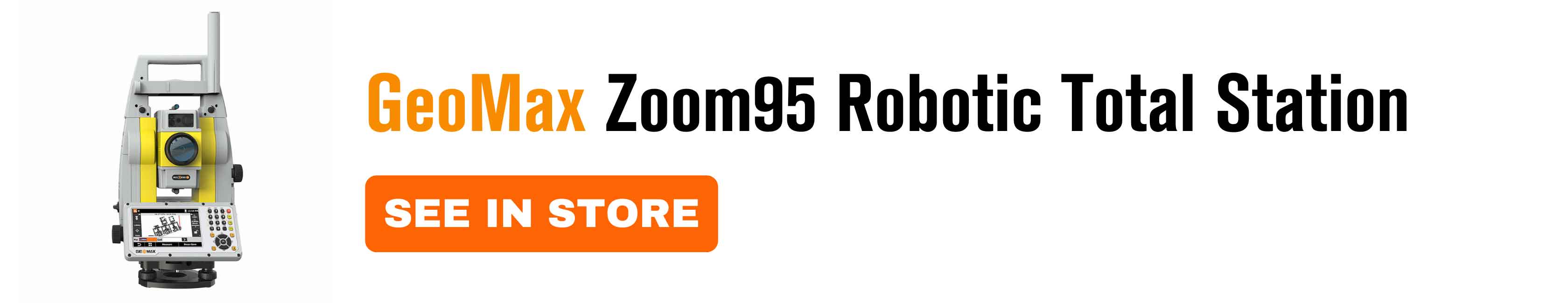
When to Opt for a Total Station
The Total Station, with its precision and versatility, is a stalwart in the world of surveying. Its capabilities make it the preferred choice for many projects, especially those requiring meticulous detail and high accuracy.
Description of Total Station
- Integrated Measurement: The Total Station combines the functionalities of a theodolite and an electronic distance metre, allowing it to measure both angles and distances with precision.
- Direct Line-of-Sight: Unlike the GNSS Rover, the Total Station requires a clear line of sight to its target, ensuring pinpoint accuracy in measurements.
Practical examples and case studies showcasing the effectiveness of Total Station
- Construction Sites: When setting out foundations, aligning structures, or installing holding down bolts for buildings, the precision of a Total Station is paramount. Its accuracy ensures that every element is placed correctly, down to the millimetre.
- Urban Environments: In densely built-up areas with tall buildings, the Total Station's line-of-sight operation is more reliable than satellite signals, which can get obstructed.
- Indoor Surveys: For projects inside buildings, such as retrofitting or interior design mapping, the Total Station is the go-to tool, given that satellite signals are ineffective indoors.
- Archaeological Sites: When excavating historical sites, where every detail matters, the Total Station provides the accuracy needed to map and document findings meticulously.
- Case Study - Historical Monument Restoration: A team was tasked with restoring a centuries-old monument. Using a Total Station, they meticulously mapped every detail of the structure, ensuring that the restoration was faithful to the original design. The tool's precision was crucial in documenting minute details, from intricate carvings to alignment of pillars.
- Setting out with high accuracy required: If holding down bolts are being installed for a structural steel building, the 1-man robotic total station is the only surveying tool that should be used. Brickwork, formwork, and façade elements should only be set out with a Total station.
- Static survey for house set out: This method can be used over a longer time to reduce errors and get a higher accuracy. Houses can also be set out but must be checked with the 6-point check with measuring tapes for square and accuracy. The 6-point check consists of the 2 side dimensions, the front and back dimensions and the 2 diagonal dimensions. These dimensions can be found on X-PAD surveying software through the Info tab with your choice of 2 points.
While the Total Station is a powerhouse in terms of accuracy and detail, it does require a more extended setup and might not be the best choice for vast, open terrains or rapid data collection. Recognizing the strengths and limitations of each tool is crucial in selecting the right instrument for the task at hand.
When to Use a GNSS Rover
The GNSS Rover, with its satellite-based operation, offers a unique set of advantages that make it the go-to choice for specific surveying scenarios. Let's delve into its primary features and the situations where a GNSS Rover shines the brightest.
Description of GNSS Rover
- Satellite Integration: The GNSS Rover taps into multiple satellite constellations, ensuring a broad coverage and reducing the chances of signal dropouts.
- Quick Setup: Unlike traditional surveying tools, the GNSS Rover doesn't require an elaborate setup. Turn it on and it's ready to collect data.
Real-world scenarios and case studies where GNSS Rover is the ideal choice
- Topographic Surveys: When mapping the contours and features of a landscape, the GNSS Rover's mobility comes into play. Its ability to quickly move around and record points without the need for line-of-sight makes it a top choice for such surveys.
- Large Area Surveys: For projects that span vast areas, like agricultural land surveys or forest mapping, the GNSS Rover's efficiency is unmatched. Its satellite-based operation allows for faster data collection over extensive terrains.
- Remote Locations: In places where setting up a base station is challenging, the GNSS Rover's independence from ground-based reference points proves invaluable.
- Rapid Data Collection: In scenarios where time is of the essence, such as disaster-stricken areas that need quick mapping for relief operations, the GNSS Rover's quick setup and operation can be a lifesaver.
- Case Study - Coastal Erosion Mapping: A team of surveyors was tasked with mapping the erosion patterns along a stretch of coastline. Using a GNSS Rover, they could quickly move along the beach, recording data points even in areas where traditional tools would struggle due to lack of line-of-sight or unstable ground for setup.
- Setting out where accuracy is less than 25mm: For housing estates, the GNSS rover can be used to set out foundations and roadways, manholes and kerb lines and boundary walls.
While the GNSS Rover offers unparalleled advantages in the above scenarios, it's essential to recognize its limitations, especially in environments with obstructions or when ultra-high precision is required. In such cases, other tools like the Total Station might be more suitable, as we'll explore next.

Head-to-Head: Advantages of Each Tool
When choosing between the GNSS Rover and the Total Station, understanding the distinct advantages of each tool can guide your decision. Let's break down the primary benefits of both instruments.
Advantages of the Robotic Total Station
- Precision: The Total Station boasts an accuracy of +/-1-2mm, making it one of the most precise surveying tools available.
- Versatility in Challenging Environments: Whether you're working under trees, close to buildings, or even indoors, the Total Station can deliver reliable results where satellite signals might falter.
- No Subscription Needed: Unlike some GNSS systems that require network subscriptions, the Total Station operates independently, reducing ongoing costs.
- Urban Efficiency: In densely populated urban areas with tall structures, the Total Station's line-of-sight operation proves more reliable than GNSS systems that can experience signal obstructions.
- Network Independence: Your surveying work isn't dependent on a connection to a network or GSM Signal for corrections, ensuring consistent operation.
Advantages of the GNSS Rover
- Rapid Deployment: The GNSS Rover can start working immediately in the field without the need for stationing, saving setup time.
- Vast Area Coverage: For land surveying, there's no limit to the area that can be surveyed with a GNSS Rover and tasks can often be completed faster than with a Total Station.
- No Line-of-Sight Required: Unlike the Total Station, the GNSS Rover doesn't need a direct line of sight to record a point, as long as there are no overhead obstructions.
- Cost-Effective: GNSS Rovers are generally cheaper to purchase and their adaptability to various conditions offers value for money.
- Flexibility and Mobility: The ease of carrying a GNSS Rover and its resilience against being knocked over makes surveying tasks more convenient and time-efficient.
In essence, the choice between the GNSS Rover and the Total Station boils down to the specific requirements of your project. While both tools offer unique advantages, understanding their strengths in various scenarios will ensure you select the most effective instrument for your needs.
Decoding Technical Terms
In the world of surveying, various technical terms and jargon can sometimes be overwhelming, especially for those new to the field. To ensure clarity and a better understanding of the tools discussed, let's break down some of the terms mentioned in this article.
ITM (Irish Transverse Mercator)
- Definition: ITM is the official coordinate system for Ireland, replacing the Irish Grid system. It's designed to be compatible with GPS and is based on a transverse Mercator projection.
- Application: ITM is used for mapping and land surveying in Ireland, providing a standardised system for accurate measurements.
Irish Grid Coordinates (also known as National Grid)
- Definition: The Irish Grid is a map reference system used in Ireland prior to the introduction of ITM. It's based on a transverse Mercator grid projection of the geographical coordinates of latitude and longitude.
- Application: While it's being phased out in favour of ITM, some older maps and surveying data might still use the Irish Grid system.
GNSS (Global Navigation Satellite System)
- Definition: GNSS is a general term for satellite navigation systems that provide autonomous geo-spatial positioning with global coverage. This includes systems like GPS (U.S.), GLONASS (Russia), Galileo (EU) and Beidou (China)and other regional satellite constellations.
- Application: GNSS is used in various applications, from navigation in vehicles to high-precision surveying tools like the GNSS Rover.
Georeferencing
- Definition: Georeferencing means associating something with locations in physical space. In surveying, it's the process of assigning real-world coordinates to each pixel of the raster, usually done with the help of control points.
- Application: Georeferencing is crucial in ensuring that survey data aligns correctly with other geographical data, making it essential for tasks like map creation or overlaying images on existing maps.
6-Point Check
- Definition: A method used in surveying to ensure accuracy by checking two side dimensions, the front and back dimensions and two diagonal dimensions.
- Application: This method is particularly useful in tasks like house set-outs to ensure the structure is square and accurate.
By understanding these terms, you can better grasp the intricacies of surveying and the tools used in the process. Whether you're a professional in the field or someone looking to embark on a surveying project, a clear understanding of these technicalities ensures a smoother, more informed experience.
The Evolution of GNSS Receivers
As technology continues to advance, so do the tools and instruments we use in surveying. One such tool that has seen significant evolution over the years is the GNSS receiver. Let's delve into its progression and understand why it's become an indispensable asset in modern surveying.
From GPS to GNSS
- GPS (Global Positioning System): Initially, receivers were designed to track only the U.S.-based GPS satellite constellation. While revolutionary at the time, this system had its limitations, especially in areas where satellite coverage was sparse.
- GNSS (Global Navigation Satellite System): With the development and operationalization of other satellite constellations like GLONASS (Russia), Galileo (EU), and Beidou (China), receivers evolved. They transitioned from being solely GPS-focused to multi-constellation devices, capable of tracking signals from various systems simultaneously.
Benefits of Tracking Multiple Satellite Constellations
- Improved Coverage: By accessing multiple constellations, GNSS receivers can provide better coverage, especially in challenging environments like urban canyons or dense forests.
- Enhanced Accuracy: More satellites mean more signals to triangulate a position, leading to increased accuracy in measurements.
- Redundancy: If one satellite system faces issues or outages, the receiver can still function using signals from other constellations, ensuring uninterrupted operation.
- Faster Signal Acquisition: With more satellites in view, GNSS receivers can acquire signals faster, reducing the time it takes to get a position fix.
- Global Operability: Regardless of the geographical location, GNSS receivers can provide accurate positioning data, making them ideal for international projects or operations.
Tough Environments and GNSS Receivers
Today's GNSS receivers are designed to be resilient. Their ability to track multiple satellite constellations means they can provide reliable data even in challenging environments:
- Near Buildings: In urban areas with tall structures, GNSS receivers can still function effectively by tapping into various satellite signals.
- Under Tree Canopy: Dense forests that might block signals from one constellation won't necessarily block signals from another, ensuring continuous operation.
- Deep Cuttings or Mines: Even in areas with significant obstructions, the versatility of GNSS receivers, combined with their multi-constellation tracking, ensures accurate data collection.
In conclusion, the evolution of GNSS receivers from single-system devices to multi-constellation powerhouses has revolutionised the world of surveying. Their adaptability, accuracy and resilience make them a cornerstone in modern measurement and mapping endeavours.
Conclusion
The realm of surveying has witnessed remarkable advancements over the years, with tools like the GNSS Rover and the Total Station leading the charge. As we've explored in this article, each instrument offers a unique set of advantages tailored to specific scenarios and requirements.
The GNSS Rover, with its satellite-based operation, is a testament to the wonders of modern technology. Its ability to quickly and efficiently cover vast terrains, combined with the flexibility of operation, makes it an invaluable asset for many surveying projects.
On the other hand, the Total Station stands as a beacon of precision and reliability. Its meticulous accuracy and versatility in both urban and challenging environments underscore its importance in projects that demand pinpoint measurements.
However, beyond the technicalities and specifications, the essence of this discussion boils down to one fundamental principle: Choosing the right tool for the job. Whether you're mapping a vast agricultural land, setting out foundations for a skyscraper, or restoring a historical monument, understanding the strengths and limitations of each tool is paramount.
In an ever-evolving world, where projects grow more complex and the demand for accuracy intensifies, having a clear grasp of available tools becomes crucial. It's not just about measuring distances or angles; it's about ensuring that every project stands on a foundation of precision, reliability and excellence.
As we wrap up this exploration, remember that the landscape of surveying will continue to evolve. New tools and technologies will emerge, but the core principle will remain unchanged: Equip yourself with knowledge, choose the right instrument and aim for perfection in every measurement.
Further Resources and Contact Information
For those eager to delve deeper into the world of surveying and the intricacies of tools like the GNSS Rover and Total Station, we've compiled a list of resources to guide your journey. Whether you're a seasoned professional or a curious novice, these materials can provide valuable insights and knowledge.
Recommended Reading
- The Surveying Handbook by Russell C. Brinker & Roy Minnick: A comprehensive guide that delves into the foundational principles and techniques of surveying, making it an essential read for both novices and seasoned professionals in the field.
- The Pincushion Effect by Jeffery Lucas: Through insightful narratives, Lucas sheds light on the challenges and nuances of the surveying profession, offering readers a deeper understanding of the intricacies involved in land measurements.
- Surveying: Principles and Applications by Barry Kavanagh: Kavanagh's work stands as a testament to the art and science of surveying, blending theoretical concepts with practical applications, making it a valuable resource for students and practitioners alike.
Contact Us
For personalised guidance, tool recommendations, or any other queries, our team is here to assist you.
- Phone: Call us at +353 (0)1 257 2323 for immediate assistance.
- Email: Drop us a message at info@hitechniques.ie and we'll get back to you promptly.
- Office: If you prefer face-to-face consultations, visit our office: Hitechniques Ltd., Unit 17 Block Q, Grants Road, Greenogue Business Park, Rathcoole, Co. Dublin, D24 N252, Ireland
- Demo and Consultation: Schedule a demo to see our tools in action or book a free consultation to discuss your project's specific needs.
Remember, the world of surveying is vast and ever-evolving. Continuous learning, coupled with the right resources and guidance, can ensure you stay at the forefront of this exciting field.