Metroscan using GeoMax equipment for utility surveying
Posted by Dariusz Liszka B.E. (Elec. Eng.), M.I.E.I. on 7th Jun 2023
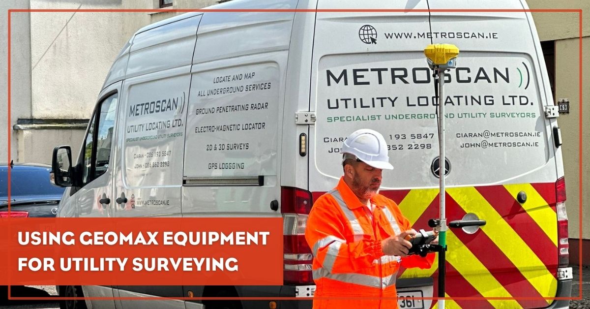
Metroscan Utility Location Ltd. is one of Ireland’s top utility surveyors with a team of professionals dedicated to providing the highest quality utility surveys and deliverables. Their customers range from small independent contractors to large multinational companies, government-run utility companies, and local and city councils.
Metroscan work all over Ireland and in all types of environments, so having reliable equipment and software plus good technical backup makes the daily challenges more manageable. It’s one of the reasons why they chose Hitechniques as their surveying equipment supplier.
We talked to John Stafford, Director at Metroscan about some of their recent projects and working with GeoMax equipment.
How long have you been using GeoMax equipment?
Metroscan have been using GeoMax instruments for seven years. I got in contact with Philip and company through their training courses and have built up a relationship from there. The team at Hitechniques are quick, efficient and love solving problems.
What made you decide to choose GeoMax equipment?
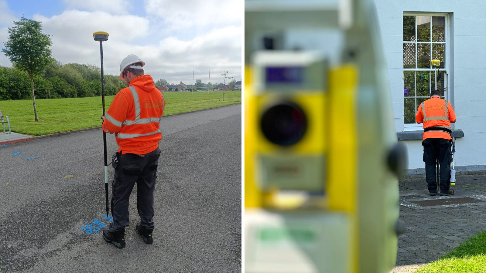
In our business, reliability and accuracy are a must, and it was proven that GeoMax equipment and X-PAD software could deliver all of this. Metroscan only uses GeoMax in our surveying fleet. GeoMax and Hitechniques helped with the integration of GNSS rovers / robotic total stations with our ground penetrating radars to provide constant GNSS data stream to radar data, which allows us to reference surveys to ITM coordinates.
Can you tell us a bit about some of the projects you’re working on?
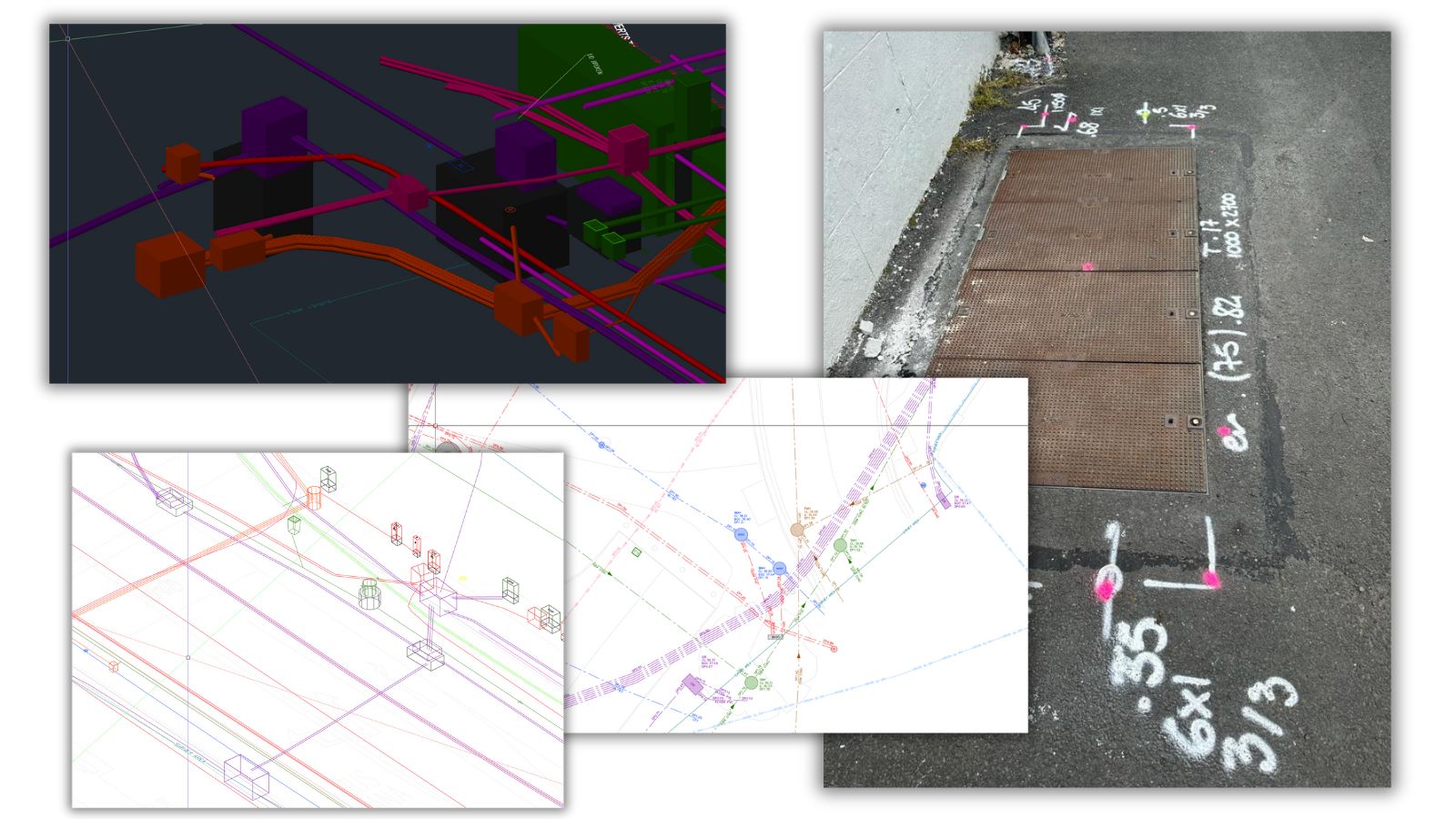
We were contracted to work on pedestrian and cycle routes in Arklow and map the underground utilities for a redesign of the town's layout. The survey was necessary to enable the town’s planner to identify services within the road corridor that may need to be relocated for the purposes of their design project.
Which of the GeoMax solutions did you use during the project?
Along with using GeoMax GNSS solutions and total stations we use their X-PAD Ultimate surveying software. The newest GeoMax Zenith60 with X-PAD 365 cloud were used to provide the best accuracy in conjunction with ground penetrating radar.
You mentioned using the X-PAD surveying software. What in your opinion makes it different from others on the market?
X-PAD is great, allowing immediate upload of survey data from the field to the cloud. It is an easy to use, stable platform to deliver surveys on time and of high quality. Our operatives find the software easy to learn and intuitive to use. Along the way X-PAD developers have come up with software patches to help our ease of use. You also feel that any issues are taken seriously and get good feedback.
How likely are you to recommend GeoMax to others?
No brainer, they offer good hardware and software plus you get great value for your money.
---
Thanks to John for sharing his and his team's experience working with Hitechniques and using GeoMax equipment. We appreciate your business and look forward to many more years of working together.
Hitechniques Team